भाकृअनुप - केन्द्रीय कृषि अभियांत्रिकी संस्थान, भोपाल
ICAR - Central Institute of Agricultural Engineering, Bhopal

Farm
CIAE Research Farm
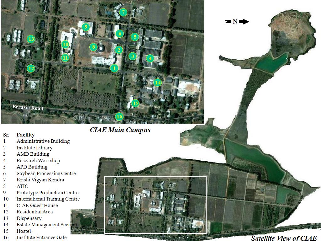
Total farm area of the Institute is 92.66 ha.
Distribution of land and under different categories are given below:
| S. No. | ||
| 1 | Crop cultivation | 27.20 ha |
| 2 | Orchards | 11.50 ha |
| 3 | Water harvesting ponds | 10.50 ha |
| 4 | Degraded waste land | 5.84 ha |
| 5 | Sports complex | 3.40 ha |
| 6 | Roads, Residential and non-residential buildings | 34.42 ha |
| 7 | Meteorological observatory | 0.30 ha |
The activities of farm is managed by (a) Farm Production & Field Research Management Section (b) Landscaping, gardening and horticulture section.
Meteorological Observatory
Agro meteorological observatory of the Institute is located 77024’10''E longitude and 23018’35''N latitude at an elevation of 498.7 m from mean sea level. Monsoon in Bhopal normally sets in on 15th June and withdraws by 30th September. Relative humidity in morning hours varies from 37 to 98% while in afternoon it varies from 13to 85% with highest of 100%. The highest weekly mean, pan evaporation and the highest weekly mean of Bright Sun Sine (BSS) are also measured and used in various applications.


